An Environment Canada meteorologist says that while most of B.C. will avoid next week’s Pacific Northwest heat wave, it’s going to be a difficult summer for the already heat-stricken region.
Doug Lundquist said that although next week’s heat dome is coming, it will largely be focused on California and Oregon, just barely touching parts of southern B.C.
“For example, like here in the southern Interior, in Kelowna we are forecasting temperatures to get back into the mid 30s C, which is a more normal type of heat for us this time of year, not really even record breaking – though there could be a few records here and there on the very hottest days,” Lundquist said. “But this is a normal pattern.”
What isn’t so normal, he said, is the sheer duration of the heat and dry weather.
“So what really bothers me is the sheer length of time that this the heat is going on,” even if it’s not hot enough to bring on heat warnings, Lundquist said.
The other concern for the southern Interior is the lack of precipitation and a forecast that shows lightning strikes.
“I’m worried about the fires,” he added.
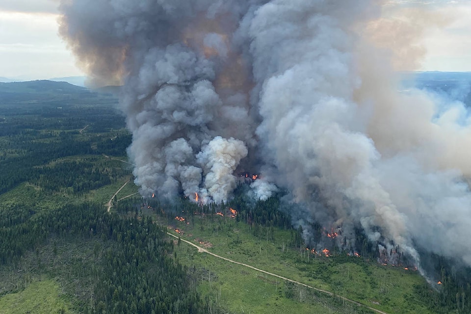
B.C. has already has a harsh few weeks on the fire front. On June 30, after breaking three records in a row – topping out at 49.6 C – Lytton burst into flames on June 30. The wildfire caused the entire village to evacuate and aerial photos show that little is left standing.
The situation in Lytton, Lundquist said, was caused by a combination of factors.
“It happened at the right time of year, right as the sun was at its highest and days were the longest.. and climate change is a piece of it, randomness is a piece,” he said. “So it’s not just one thing, it all adds up.”
READ MORE: ‘We are all still reeling’: Open letter from Lytton details devastation from deadly wildfire
Lundquist said that while climate change will raise temperatures on average, not every summer will be blazing hot and break heat records.
“Remember, there’s variability – not every year is warmer than the previous, we might have a cooler summer because there is randomness to weather and meteorology,” he said. “So it’s not gonna be every single year but in general over time, I think the expectation is that the climate should continue to warm.”
There have been 750 fires in total this year, 114 of which have started in the past week. Of the total fires, 202 are burning right now; 73 in the Kamloops Fire Centre, 53 in the Cariboo Fire Centre, 39 in the Prince George Fire Centre, 22 in the Southeast Fire Centre, eight in the Northwest Fire Centre and seven in the Coastal Fire Centre.
Of those active fires, 14 are “wildfires of note,” defined by the BC Wildfire Service as those that are “highly visible or which pose a potential threat to public safety.”
Of the 750 total fires, lightning has accounted for 39.9 per cent. However, that goes up for the 202 active fires, 20 of which have been sparked in the past two days. Of those 202 fires, 72.3 per cent are considered to be caused by lightning.
Lundquist said the dry weather is expected to continue for weeks. He said that there is a “month, maybe more” until late August storms wet down the province and decrease the risk of fires.
“I’m worried that because it’s been so dry, it’s harder for the atmosphere to let the rain make it to the surface – it tends to evaporate more easily. So we may not get significant rains until later in August or September,” he said. “We’re coming from a difficult spot.”
And other regions outside the Okanagan won’t get a break either.
“In the Kootenays, it’s hot,” Lundquist said. “Same in the Central Interior; in Fort St. John we’re forecasting highs in the 30 C range all the way through till the end of the work week… in Prince George, the forecast is for high 20s to low 30s, which is way warmer than their average high of about 22 C.”
While the south coast regions will be cooler than the rest of B.C., they’ll still be unseasonably warm.
“In Vancouver near the water, the forecast is for mostly sunny almost every day, highs into the mid 20s on the coast and getting hotter inland,” Lundquist said, noting that temperatures will hit 30 C in the deeper reaches of the Fraser Valley.
“On the island… the highs are going to be in the mid to high 20s from the end of the work week through early next week.”
But one thing each region will have in common?
“No measurable, no real significant precipitation for any part of the province and And in the interior (there’s) just that threat of more lightning over the next couple of days.”
